Jomolhari Trek
12 Days 11 Nights
Trek Facts
- Dificulty Level:

Medium-Hard  Duration: 12 Days 11 Nights
 Altitude: 5,000 m
 Season:April - June & Mid Sept - Mid Nov
 Group Size: 1 pax & above
Package Includes
Three-star plus hotel accommodation, three meals a day, SUV/mini bus/coaster, guides, trekking gears, camping equipments, entry fees, mineral water, cultural program (in groups of 10 or more people), & taxes.
Package Excludes
Air tickets, travel insurance, drinks, visa fee & laundry
Video
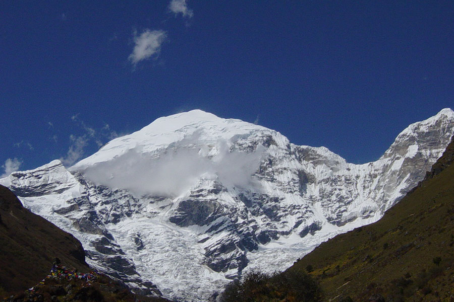
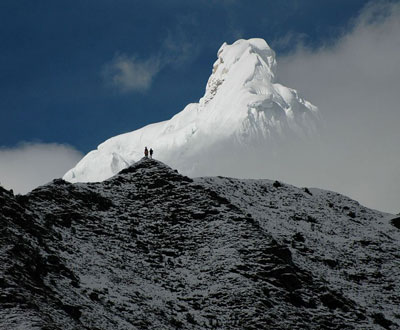
This Jomolhar Trek is considered as the most beautiful trek in the eastern Himalayas. It encompasses two of the country’s most famous valleys, Paro and Thimphu, with trails passing through a great diversity of landscape and vegetation with altitudes ranging between 2,500m to nearly as high as 5,000m. The trek offers magnificent views of Bhutan’s most sacred mountain, Jomolhari (the abode of powerful female deity called Aum Jomo) and several other towering snow-capped peaks. The trek also offers majestic scenes throughout the journey.
Attraction
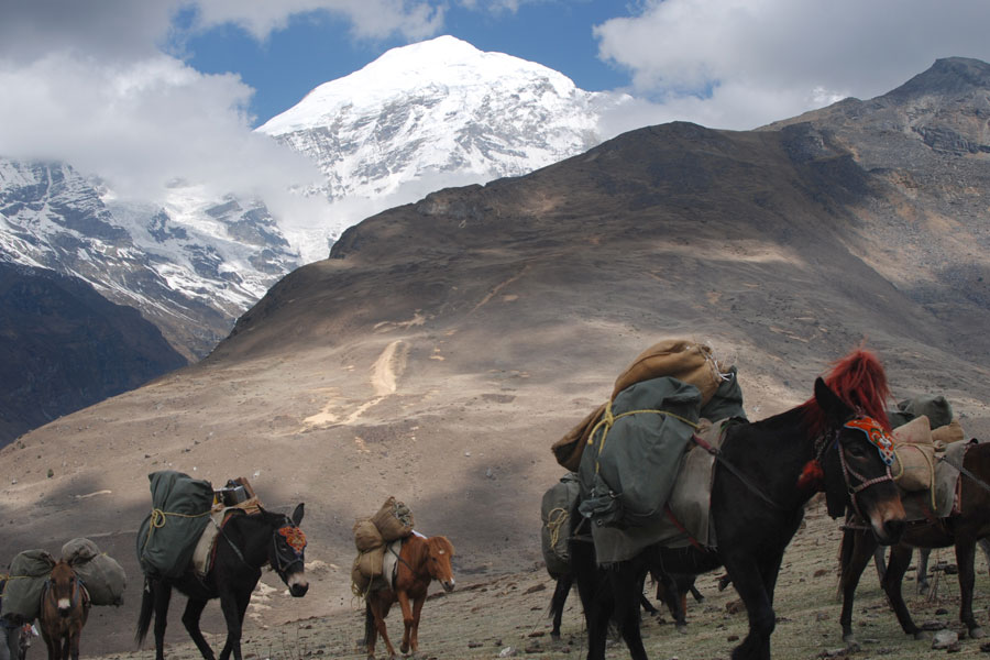
- Magnificent views of Mt. Jomolhari (7,300m), Jichu Drake (6,794m), Tsheringang (6,789m), Masang Gang (7,165m) and a number of unclimbed peaks in the eastern Himalayas.
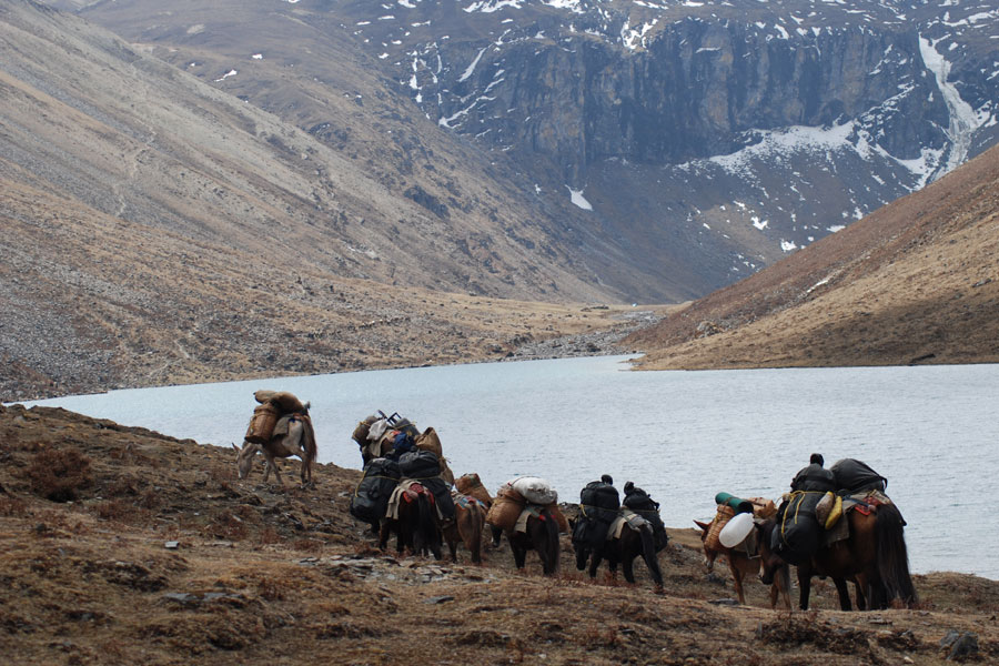
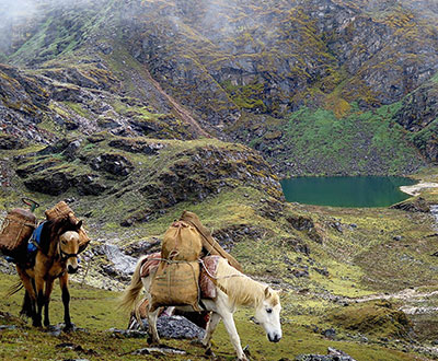
- The upper reaches of Paro and Thimphu rivers, Tshophu lake (4,380m), numerous beautiful waterfalls, the ruins of Barshong Dzong.
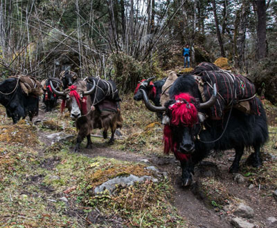
- Alpine meadows, forests of rhododendron, birch, conifer, maples and bamboos and pasture lands, blue sheep, yaks, Jigme Dorji National Park, high mountain ridges, passes at Bhonte La (4,890 m) and Yelila (4,930m).
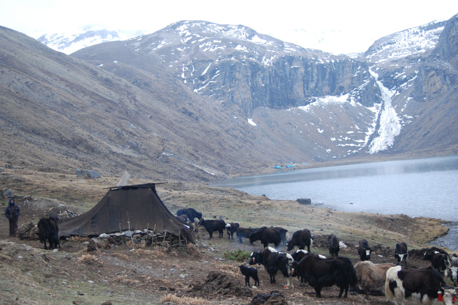
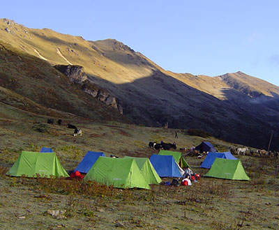
- The villages of Soe, Takethang, Dangochang, Jangothang (one of the most beautiful campsites in the Himalayas) and yak herder’s homes.
Detailed Itinerary
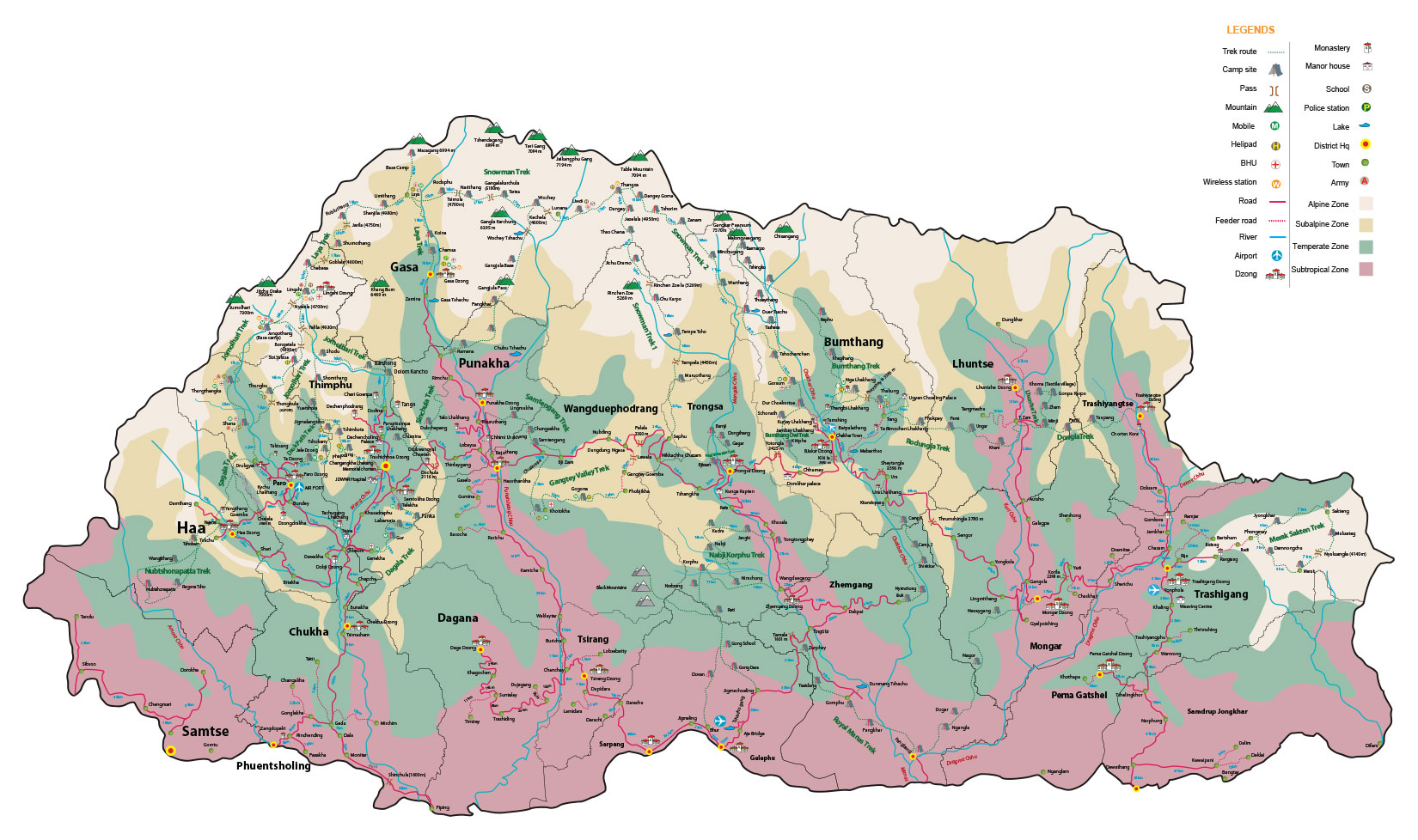
Day 1: Gunitsawa village – Sharna Zampa
Time: 40mins, Descent: 80m, Camp Altitude: 2,850 m.
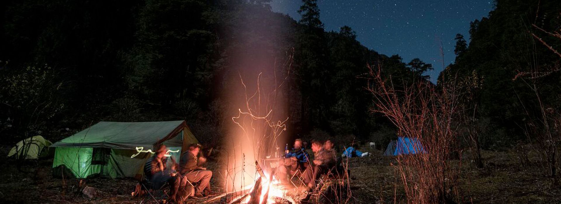
Today, you will just get yourself acclimatize for the actual trek, which would begin tomorrow. You will start from Gunitsawa village and then pass an army checkpoint. At the checkpoint, validate your trek permit for endorsement, which will be given to you by your tour operator. Night at the campsite, which is on the other side of the river.
Day 2: Sharna Zampa – Thangthangkha
Distance: 22 km, Time: 7-8 hours, Ascent: 770m, Descent: 10m, Camp Altitude: 3,610m.
It will be a long day today. The hike takes you through an undulating trail and then an uphill climb till the valley narrows gradually to a path. You will then descend to a meadow where you will camp for the night. One can have the first view of the popular Mount Jomolhari on a clear day from the campsite.
Day 3: Thangthangkha – Jangothang
Distance: 19 km, Time: 5-6 hours, Ascent: 480m, Camp Altitude: 4,080 m.
Continue trek up the Paro Chhu valley. The path widens into patches of alpine meadow and scanty forest growths. You will cross another army checkpoint along the way. Also, apparent on the trek are local yak herders tending their yaks. You will pass the villages of Soe, Takethang and Dangochang today before you camp at Jangothang – another spot from where you can see the Mount Jomolhari.
Day 4: Jangothang (Halt)
Today, you will halt at Jangothang with the option to day hikes and trails leading to three directions. If photography is your love or passion, you can engage in it in a lot of ways. Jomolhari and its subsidiary mountain chains lay directly to the west, Jichu Drake to the north, besides a number of unclimbed peaks to the east. It’s also a good time to acclimatize for the remaining days of the trek.
Day 5: Jangothang – Lingshi
Distance: 18 km, Time: 6-7 hours, Ascent: 840m, Descent: 870m, Camp Altitude: 4,010m.
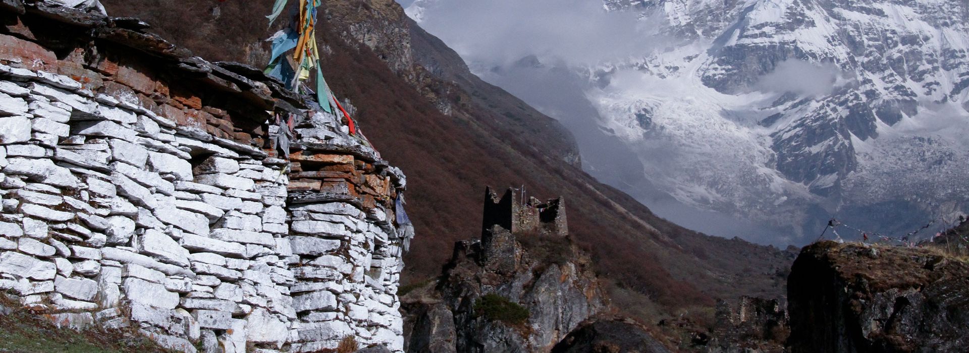
After the rest yesterday, it’s time to continue on the trek today. After a short walk from the campsite, hike uphill for about 30 minutes and then the climb becomes more gradual till you reach the Nyilila pass at 4,870m. Enjoy the spectacular views of Mt. Jomolhari, Jichu Drake and Tsherimgang from here, all of them above7,000m. You might also encounter blue sheep along the way before you descend and reach the yak herders’ tents. You will then enter the Lingshi basin - a beautiful u-shaped valley. One can see the Lingshi Dzong on a clear day; Tserimgang and its glaciers rise up at the north-end of the valley. Campsite is next to a stone just before the Lingshi Dzong.
Day 6: Lingshi – Chebisa
Distance: 10 km, Time: 5-6 hours, Ascent: 280m, Descent: 410m, Camp Altitude: 3,880 m.
Today’s hike will basically be the shortest one. After reaching a stupa below the Lingshi Dzong (4,220m), you have the option to stay on the main trail or take a detour up to the Lingshi Dzong. After Lingshi Dzong, you will then pass through the villages of Lingshi and Goyul. In Goyul village, one can see stone houses clustered together to form a small compact village - quite unusual in Bhutan where settlements are usually scattered. After reaching the campsite at Chebisa, one can visit the local village and for glimpse of a beautiful waterfall behind the village.
Day 7: Chebisa – Shomuthang
ance: 17 km, Time: 6-7 hours, Ascent: 890m, Descent: 540m, Camp Altitude: 4,220m.
Ascend for about three hours through a pastureland towards Gobula pass (4,410m) and then descend into a valley. Climb uphill again for a while and descend again to Shakshepasa valley (a large u-shaped valley at 3,980m). Climb again till you reach the campsite at Shomuthang, which is just above a river.
Day 8: Shomuthang – Robluthang
Distance: 18 km, Time: 6-7 hours, Ascent: 700m, Descent: 760m, Camp Altitude: 4,160 m.
Begin the day by climbing up the valley till you see Mount Kang Bum (6,526 m) and some clusters of edelweiss. Climb again till you reach Jhari-la (4,750m), from where you catch the first glimpse of Sinchela, the pass that you will cross the day after. The big snow-covered peak in the north is Gangchhenta (6,840 m), better known as the Great Tiger Mountain. If the weather permits, Tserim Kang and the top of Jomolhari will also be visible. Some herds of takin, the Bhutanese national animal, migrate to this valley during the summer and remain here for about four months. The valley as such has also been declared as a takin sanctuary. Start climbing again till the campsite at Robluthang
Day 9: Robluthang – Limithang
Distance: 19 km, Time: 6-7 hours, Ascent: 850m, Descent: 870m, Camp Altitude: 4,140m.
Begin the day by ascending for about an hour after which the trail becomes more gradual for the next 90 minutes through a boulder field. Climb uphill for an hour again to reach the Sinchela pass (5,005m) – the final and the highest pass on the trek. Then descend and you can see an impressive terminal moraine and a glacial lake at the foot of the valley. One can spot the classic examples of the lateral moraines, where the glacier has pushed rocks up on both sides of the valley. Below the moraine cross the Kango Chhu and reach the campsite at Limithang, from where one can see the Mount Gangchhenta.
Day 10: Limithang – Laya
Distance: 10 km, Time: 4-5 hours, Ascent: 60m, Descent: 340m, Camp Altitude: 3,840m.
There is not much climbing to do today. Walk downhill along a narrow, winding river valley. After that the trail takes you through a densely forested region and then leads you to the west side of Laya village. From the west of the village, one can have spectacular views of the Mt. Gangchhenta and Mt. Masagang. In the village, there is also a community school and a basic health unit with telephone connection. Today’s campsite is below the school.
Day 11: Laya – Koina
Distance: 19 km, Time: 6-7 hours, Ascent: 260m, Descent: 1,070m, Camp Altitude: 3,050m.
The trail today winds up-and-down along the river valley of Mo Chhu and offers breath-taking views of the raging river, feeder streams and waterfalls. A lot of up-and-down hike will lead you to Kohi Lapcha at 3,300m. The trek then drops down to the large stream of Koina Chhu, where one can find the campsite of Koina.
Day 12: Koina – Gasa (Trek ends)
Distance: 14 km, Time: 6-7 hours, Ascent: 740m, Descent: 1,500m, Camp Altitude: 2,240m.
One has to climb for the last time today to cross over the Barila pass (3,740m). Then descend towards Gasa village (2,770m). One can chose to camp near the Gasa Dzong or descend for another hour to the Gasa Tsachu (hot springs) and relax in the rejuvenating mineral waters. Gasa Tsachu is one of the most popular hot springs in Bhutan.