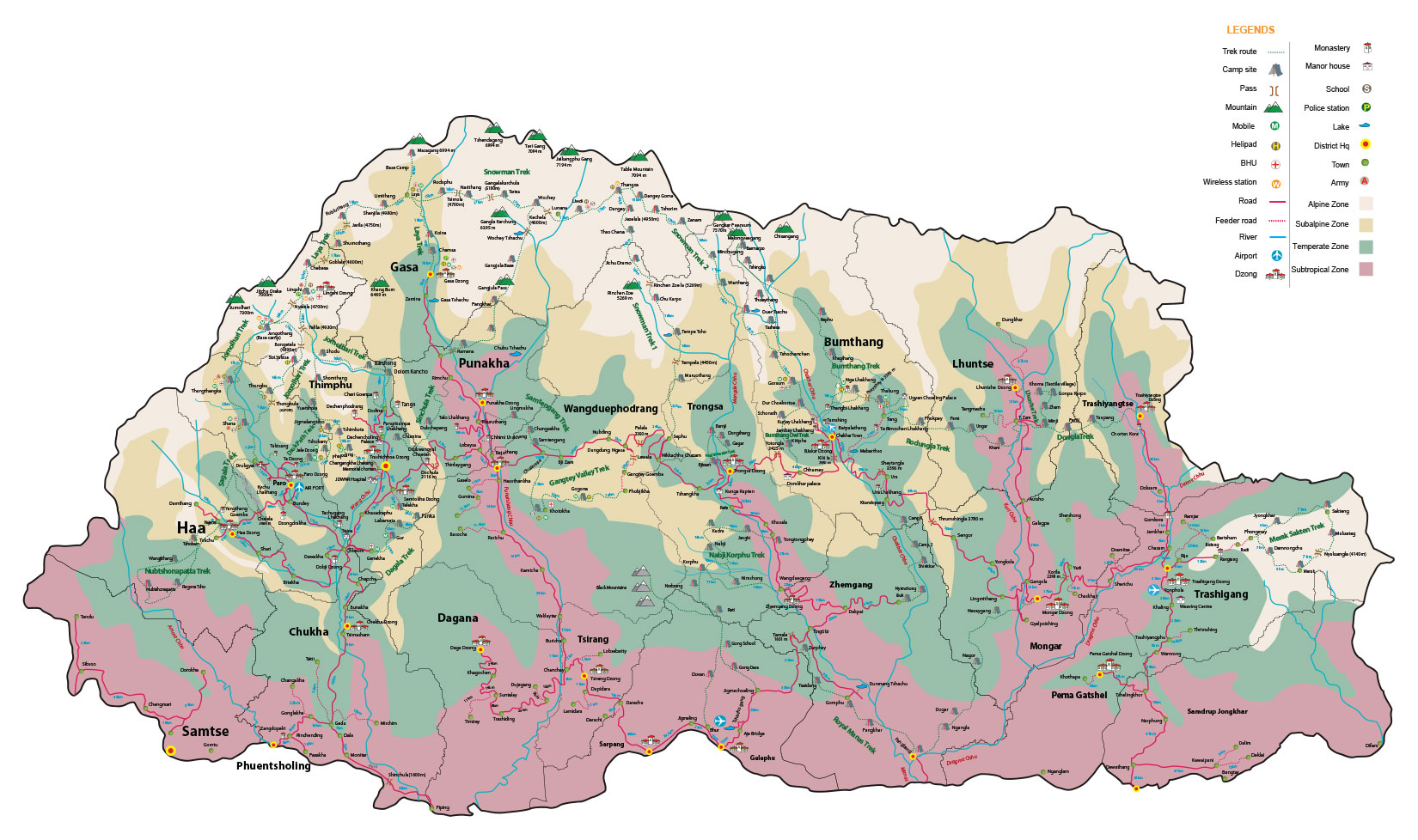
Snowman Trek
24 Days 23 Nights
Trek Facts
- Dificulty Level:

Hard  Duration: 24 Days 23 Nights
 Altitude: 5,320m
 Heighest Camp: 5,120m
 Season: Mid June - Mid October
 Group Size: 1 pax & above
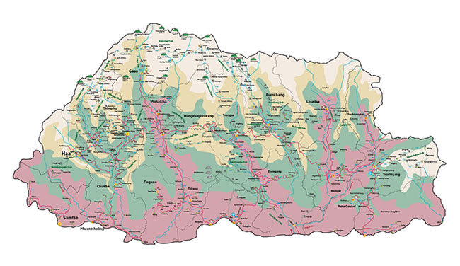
 Trip Starts: Gunitsawa, western Bhutan
 Trip Ends: Dur, central Bhutan
Mountain Views Enroute
Mt. Jomolhari (7,300m), Jichu Drake (6,794m), Tsherimgang (6,789m), Kang Bum (6,526m), Gangchhenta (6,840 m), Gangla Karchung (6,395m), Jekangphu Gang (7,100m), Tsenda Kang (7,000m) and Teri Gang (7,300m), Table Mountain (7,100m), Gangkar Puensum (7,570m).
Mountain Passes Enroute
Nyilila pass (4,870m), Gobu La (4,410m), Sinche La (5,005m), Tsomo La (4,900m), Gangla Karchung La (5,120m), Keche La pass (4,650m), Gophu La pass (5,230m), Juli La (4,700m), Saka La (4,800m).
Package Includes
Three-star plus hotel accommodation, three meals a day, SUV/mini bus/coaster, guides, trekking gears, camping equipments, entry fees, mineral water, cultural program (in groups of 10 or more people), & taxes
Package Excludes
Air tickets, travel insurance, drinks, visa fee & laundry
Video
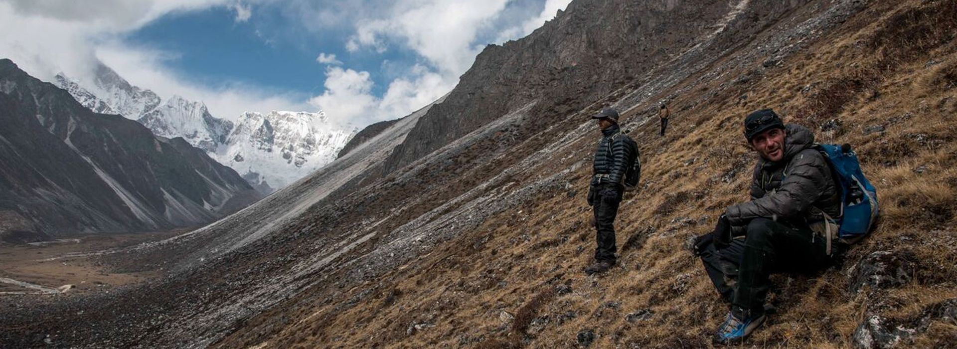
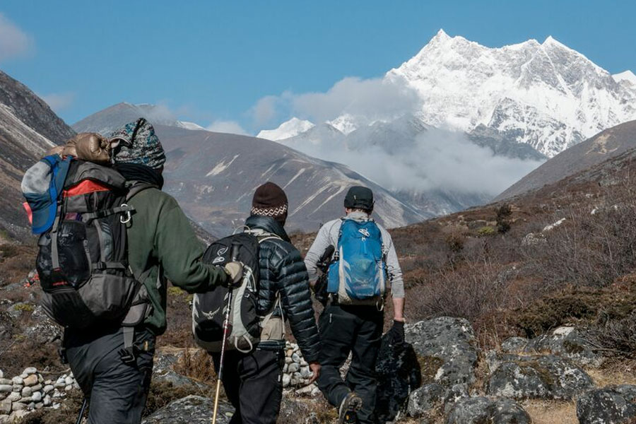
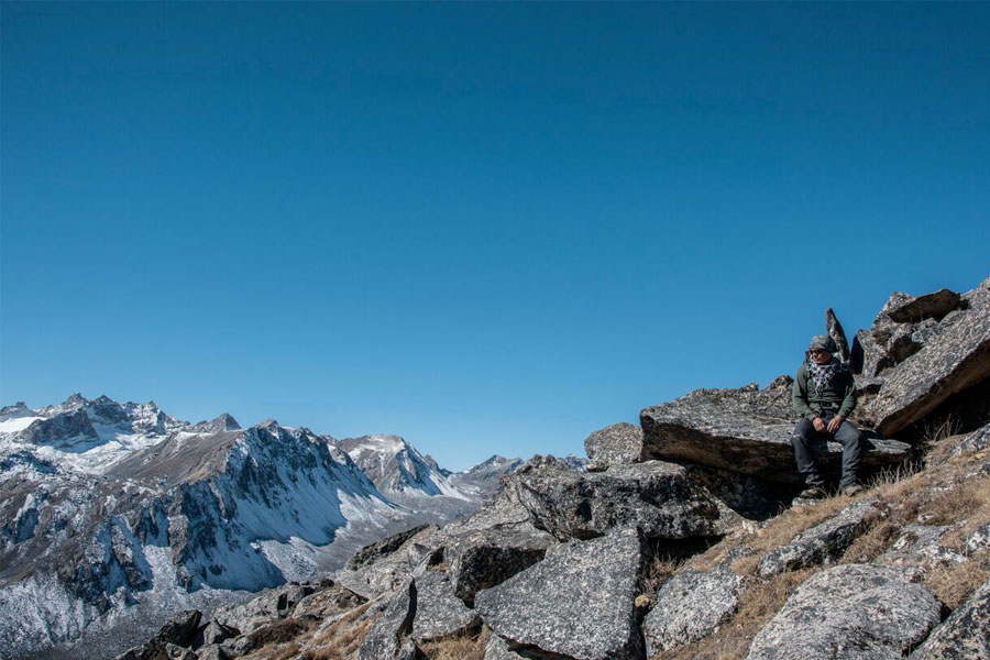
Touted as one of the most challenging treks in the world, it takes trekkers into the extreme snow-capped northern frontiers of the high Himalayas.
Breathtakingly beautiful, the route traverses highland settlements, amazing vistas of Bhutan’s highest mountains, and more than a dozen scenic mountain passes, where only a very few have stepped before. The journey is unforgettable as it meanders through alpine meadows, conifer, juniper and rhododendron forests, beautiful and balmy hot springs, valleys inhabited by yak herders and highlanders, glacial lakes, the head waters of Bhutan’s major rivers and spectacular views of the Tibetan plateau.
This region of the world is also the home of the elusive snow leopard, the blue sheep, the takin, and many other varieties of wildlife. The experience is mostly out-of-the-world, quiet and meditative with only the pristine nature as your only companion from the start to the finish.
Detailed Itinerary
Day 1: Gunitsawa village - Sharna Zampa
Time: 40 minutes, Camp Altitude: 2,850m
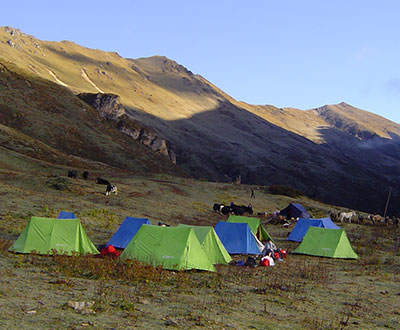
The trek begins at Gunitsawa village. It then leads to an army post and a checkpoint where one’s trek permits provided by your tour operator will be checked and endorsed. The campsite today is on the other side of the river; not very far from Gunitsawa village.
Day 2: Sharna Zampa - Thangthangkha
Distance: 22km, Time: 7-8 hours, Camp Altitude: 3,610m
The second day of the trek is a bit long and tiring. The trail continues ascending till 770m and descending another 10m. The uphill hike through the river valley narrows gradually to a lone path, and then descending to a meadow where a camp will be set up for the night. If the weather favors, one can be able to have the first glimpse of the Mt. Jomolhari.
Day 3: Thangthangkha - Jangothang
Distance: 19km, Time: 5-6 hours, Camp Altitude: 4,080m.
The trek continues upwards to the Paro Chhu valley. Along the way one can enjoy the spectacular view of high mountain ridges and snow-capped peaks. Trekkers will also pass through the villages of Soe, Takethang and Dangochang. The day ends at Jangothang - one of the most beautiful campsites of the Himalayas – from where one can also view the Mt. Jomolhari.
Day 4: Jangothang (Halt)
Take a rest today at Jangothang. The day allows one to take day hikes with beautiful views of the lakes and mountains like Jomolhari and Jichu Drake. There are also good short hiking trails in three directions. Jomolhari and its subsidiary mountain chains lay directly to the west, Jichu Drake to the north, and a number of unclimbed peaks to the east. Today is also a good chance to spot the blue sheep.
Day 5: Jangothang - Lingshi
Distance: 18km, Time: 6-7 hours, Camp Altitude: 4,010m.
One of the longest hikes of the trek will be today. After a short walk from the camp, the trail is a rapid climb for about half an hour with about 840m ascent till the Nyilila pass at 4,870m. One can spot herds of blue sheep grazing on the mountain slopes. The trek is then greeted by the beautiful u-shaped valley in the Lingshi basin, which offers a wonderful view of the Lingshi Dzong, while Tserimgang and its glaciers rise up at the north end of the valley. The campsite is next to a stone hut, just before reaching the Lingshi Dzong.
Day 6: Lingshi - Chebisa
Distance: 10km, Time: 5-6 hours, Camp Altitude: 3,880m.
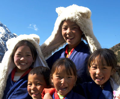
The shortest walking day is today. A little further below the Lingshi Dzong, trekkers have the choice to stay on the main trial or take a detour up to the Dzong. Trekkers will also pass through the clustered village of Goyul. On reaching the campsite at Chebisa, one will have plenty of time to visit the people in the village and explore the beautiful waterfall located behind the village.
Day 7: Chebisa - Shomuthang
Distance: 17km, Time: 6-7 hours, Camp Altitude: 4,220m.
The trek today begins with a long ascent behind Chebisa village and through a wide pastureland towards Gobu La pass, which will take about 2-3 hours. There are also chances of spotting large herds of blue sheep above the trail. After crossing the 4,410m Gobu La pass, one has to descend into the valley and then climb again for a short while before descending again to Shakshepasa valley. After another short climb, you will reach the campsite at Shomuthang.
Day 8: Shomuthang – Robluthang
Distance: 18km, Time: 6-7 hours, Camp Altitude: 4,160m.
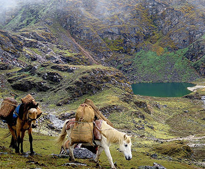
The day begins with gradual climbing up the valley to view Kang Bum (6,526m) and some groups of edelweiss. After two hours of uphill climb, you will then reach the 4,750m Jhari La- a spot from where one can catch the first glimpse of Sinche La pass. A big snow peek is visible in the north called Gangchhenta (6,840m). It’s also known as the Great Tiger Mountain. After descending, one will reach the beautiful and wide valley of Tsheri Jathang. This valley has been declared as a sanctuary of the Takin (the national animal of Bhutan). A little climb uphill will then lead you to your campsite in a rocky meadow at Robluthang.
Day 9: Robluthang to Limithang
The trek will start today with an initial 40-60 minutes ascent. Then there is another hour and a half through a boulder field. It then starts on an hour of steep ascent before reaching the Sinche La at 5,005m - the final and highest pass on the trek if you do not intend to continue the Snowman Trek from Laya.
One can also see a glacial lake at the foot of the valley, besides classic examples of lateral moraines. Cross the Kango Chhu below the moraine and reach the Limithang campsite, where the peak of Gangchhenta towers over the campsite.
Day 10: Acclimatisation day in Laya
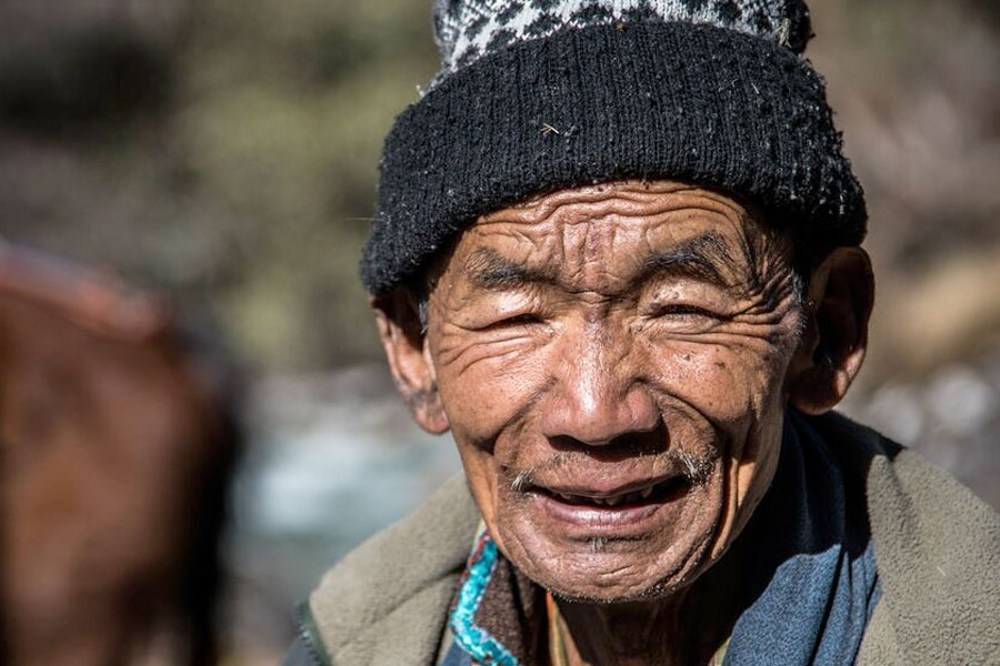
Today is a day to recuperate from the trek to Laya and prepare you for the rest of the challenging trek. It is recommended to walk up to Laya to acclimatise and not just stay at the junction leading to Lunana. It is also worthwhile to spend a day in Laya to enjoy the beautiful views and experience the extraordinary inhabitants of Laya.
Day 11: Laya - Rhoduphu
Distance: 19km, Time: 6-8 hours, Camp Altitude: 4,160m.
Descend to an army camp today and continue following the river till the turn-off point to Rhoduphu from Laya. Continue to climb through rhododendron bushes after lunch till you reach the campsite just next to a river in Rhoduphu.
Descend to an army camp today and continue following the river till the turn-off point to Rhoduphu from Laya. Continue to climb through rhododendron bushes after lunch till you reach the campsite just next to a river in Rhoduphu.
Day 12: Rhoduphu - Narethang
Distance: 17km, Time: 5-6 hours, Camp Altitude: 4,900m.
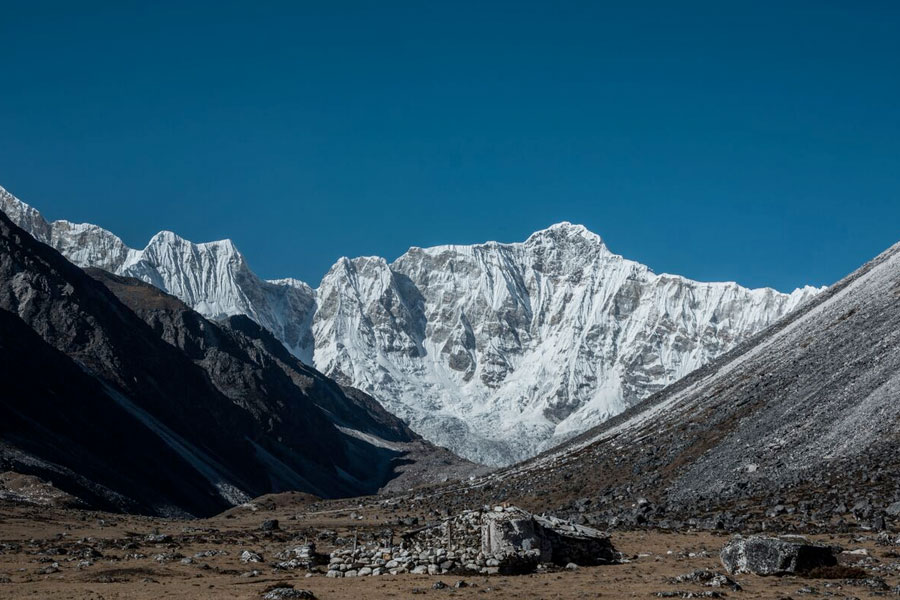
Follow the river for about half an hour till you face a steady climb to a high open valley at an altitude of 4,600m and then hike further up to Tsomo La pass (4,900m). The pass offers an outstanding view of Lunana, Mt. Jumolhari and Jichu Drake. One can also see the Tibetan border. The trial after the pass crosses a flat barren plateau at about 5,000m. The campsite at Narethang is towered by the peak of Gangla Karchung (6,395m).
Day 13: Narethang - Tarina
Distance: 18km, Time: 5-8 hours, Camp Altitude: 3,970m.
Climb for about an hour to Gangla Karchung today. The view from the pass is spectacular and the whole mountain ranges like Jekangphu Gang (7,100m), Tsenda Kang and Teri Gang (7,300m) are visible. As the pass descends along a large moraine, one can see a massive glacier from Teri Kang to a deep turquoise lake at its foot. Then make a very long descent through thick rhododendron to Tarina valley. You will find several good campsites along the Tang Chhu.
Day 14: Tarina - Woche
Distance: 17km, Time: 6-7 hours, Camp Altitude: 3,910m.
The walk today follows down through conifer forests, following the upper ridges of the Pho Chhu, and passing some impressive waterfalls en route. The trail then goes up over a ridge and drops to Woche, where you will find a settlement of a few houses. This is the first village in the Lunana region.
Day 15: Woche - Lhedi
Distance: 17km, Time: 6-7 hours, Camp Altitude: 3,700m.
The trek begins through juniper and fir forests, and rhododendron bushes. The climb up to Keche La pass (4,650m) takes trekkers to grand views of the surrounding mountains. After the pass, descend to the riverside walking through a village with a stunning view of the Table Mountain and others. Then follow up the river till the Lhedi village.
Day 16: Lhedi - Thanza
Distance: 17km, Time: 7-8 hours, Camp Altitude: 4,150m.
Trekkers can have great views of the Table Mountain (7,100m) on a clear day from here. At around lunchtime you will reach the small village of Chozo, which has a Dzong that is still in use. One can see the Table Mountain again, forming a 3,000m high wall of snow and ice behind the village, upon reaching Thanza. There are possibilities to camp at Thanza, but most groups prefer to camp in Thoencha.
Day 17: Rest at Thanza
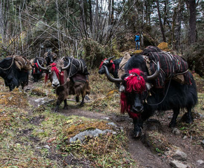
Take a rest today at Thanza and walk around the village to experience the people’s way of life. One can also climb up the ridge for enthralling views of lakes and mountains. From here, arrangement for new yaks would be done for the rest of the trek.
Day 18: Thanza - Tshorim
Time: 8-9 hours, Camp Altitude: 5,120m.
After having chosen the route to Bumthang, the trek begins by climbing a ridge with a great view of the Table Mountain and the Thanza valley below. The ridge’s altitude is 4,500m and it rises gradually up to 4,650m. After lunch, walk upwards towards the left side of the bridge to enjoy the view of high snow-capped mountains, and climb more ridges till you reach the campsite at Tshorim.
Day 19: Tshorim - Gangkhar Phuensum Base Camp
Time: 6-7 hours, Camp Altitude: 4,970m.
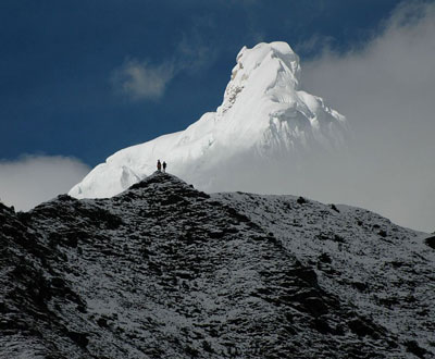
Today will be the best part of the trek. The day begins with a gradual climb to the Tshorim Tsho. Walk on the sides of the lake and enjoy a panoramic view of the Gophu La ranges. After the pass, descend to the base camp, walking along the ridge to enjoy a great view of Gangkhar Phuensum. One can also, if interested, divert to the left side to climb up the pyramid-peak for a better view or one can go down to the base camp near Sha Chhu.
Day 20: Gangkar Phuensum Base Camp to Geshe Woma
Time: 6-7 hours, Camp Altitude: 4,200m.
The trail today further follows the Sha Chhu and descends gradually to Geshe Woma.
Day 21: Geshe Woman - Warathang
Time: 8-9 hours, Camp Altitude: 4,000m.
The trail continues following the Sha Chhu for two and a half hours until the beginning of the stiff climb to Saka La. As visibility along the Saka La trail is poor, one must see the top of the ridge for direction and guidance. After lunching nearby a yak herders’ camp, climb up to the Saka La (4,800m) pass. Follow the path that then descends to a couple of lakes before making another stunning short ascent. The scenery once again is beautiful with small lakes and mountain peaks.
Day 22: Warathang – Duer Tsachu
Time: 5 hours, Camp Altitude: 3,590m.
After an hour climb leads to Juli La (4,700m). Then descend to the riverside through dense rhododendron, juniper and conifer forests. After the bridge and a short climb leads to Duer Tsachu, where the hot springs there is where Guru Padmasambhava is supposed to have taken baths. This may be the most stunningly beautiful hot springs of the Himalayas. Trekkers often want to spend an extra day at the Duer Tsachu.
Day 23: Duer Tsachu – Tshochenchen
Time: 8-9 hours, Camp Altitude: 3,850m.
Make a long and steady climb again from the hot springs with great views of mountains in Lunana en route. One will also come across blue lakes and yak herders’ huts.
Day 24: Tshochenchen – Duer Village
It’s the last day of the trek today and you will have horses as your porters instead of the yaks. The path today follows the Chamkhar Chhu and then gradually descends with a fewer climbs in between. The trek ends when you arrive at the Duer village. Then drive to Jakar (Bumthang) from here.